Bertelsen Nature Park
was threatened by the WEP (2004 essay)
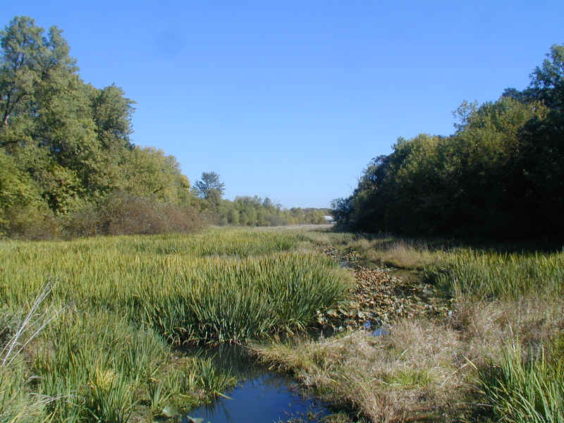
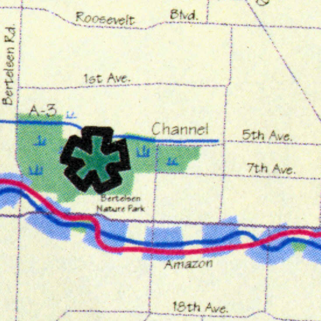
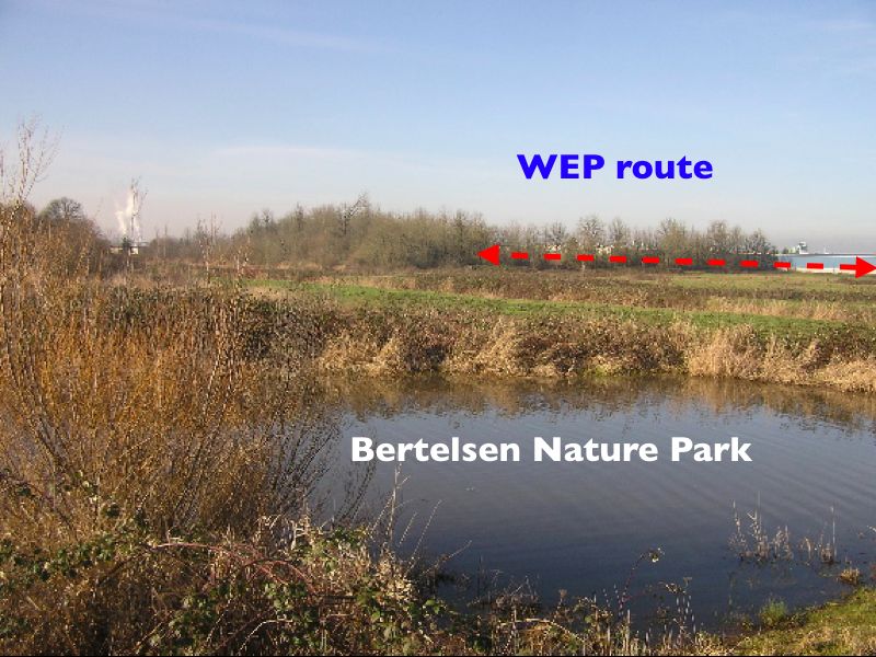
The WEP would take out much of the forest on the north side of Bertelsen Slough (left side of the photo). This is the last ecosystem of its type left in Eugene. This is part of the "A-3" tributary of Amazon Creek, the most polluted waterway in the city. Bertelsen Slough is "owned" by Oregon Department of Transportation, and after the WEP is canceled, it should be turned over to the Bureau of Land Management's wetland conservation program. While using the WEP route as additional wetland buffers for Amazon Creek would not be sufficient to restore clean water, it would be the best use for these public lands.
Only a small part of the "porkway" route (west of Beltline between Danebo and Green Hill Roads) has recently received significant concern about environmental impact from this $150 million boondoggle. (This pricetag is a low estimate for the full project, which would run from Veneta, across Fern Ridge, through the West Eugene Wetlands and then in an unspecified manner along or near 6th and 7th to the Washington-Jefferson bridge.)
The first segment to be built - from Beltline to Seneca - would decimate a diverse range of habitats - forested wetlands, open swamp, prairie and fill in an Amazon Creek tributary. These areas are walking distance from many residential neighborhoods and the west 11th strip malls, yet are virtually unknown to most Eugenians.
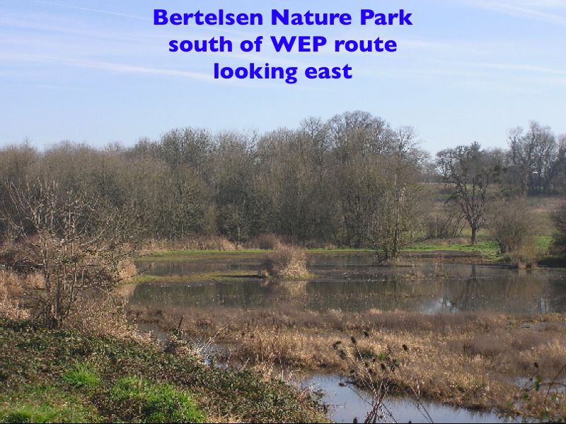
For two years, we have taken interested citizens on tours through the newly designated "Bertelsen Nature Park," which is managed by the Bureau of Land Management for native ecosystem restoration. Some of the natural areas we walk through are still owned by the Oregon Department of Transportation. We seek their transfer to the BLM for conservation purposes after the WEP is officially canceled due to its many technical, financial, ecological and legal problems.
The "east of Beltline" segment of the WEP would have nearly all of the direct creek damage - about one half kilometer of direct obliteration (relocation, covering over and bridging), and most of the deforestation. The segment from Danebo to Green Hill Road has rarer plants and endangered Fender's Blue Butterflies and greater acreage of wetland impacts, but less direct impact to streams.
In the late 1980s Environmental Impact Statement, the "wetlands" concerns were east of Beltline, and the west of Beltline segment was given little concern. Now, the elite consensus has flip-floped, and the segments west of Beltline are worth of concern and those east of Beltline are slated for sacrifice.
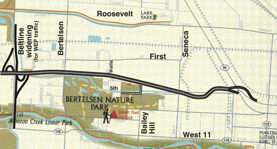
This map is excerpted from "Welcome to Eugene's Parks, Recreation and Open Space!," a September 2003 publication of the City of Eugene. The drawing of the WEP route was added - the City's map does not hint at their plans to pave the parklands, and even implies that several ODOT and City of Eugene parcels bought for the freeway are actually protected areas.
This map of Bertelsen Nature Park is from a planning document for regional park systems from Lane Council of Governments. The so-called parkway would parallel the Amazon A-3 tributary, with polluted road run-off further degrading water quality.