WEP route spring 2005
These photos were taken May 25, 2005 at an ODOT presentation at Willamette High School in north Eugene. The eastern terminus photo shows a significant expansion of the WEP design compared to earlier designs used in the 1997 Supplemental Draft EIS (the design used to sell the WEP to the Eugene voters in 2001) and the subsequent "Alternative A Mitigated" design crafted in 2003. Citizens who want to know what schemes are being hatched by ODOT and its contractors have to attend - in person - these intermittent events in order to learn about these sorts of subtle design changes that carry very large price tags. While the maps were shown to the public for viewing, ODOT staff and their contractor did not call attention to this substantial change in design.
In October 2005, ODOT unveiled a new variation that eliminated the grade separated overcrossings of WEP at 6th / 7th Avenues, and reverted back to the Couplet Alternative that was discarded in 1985 as unpopular and unworkable.
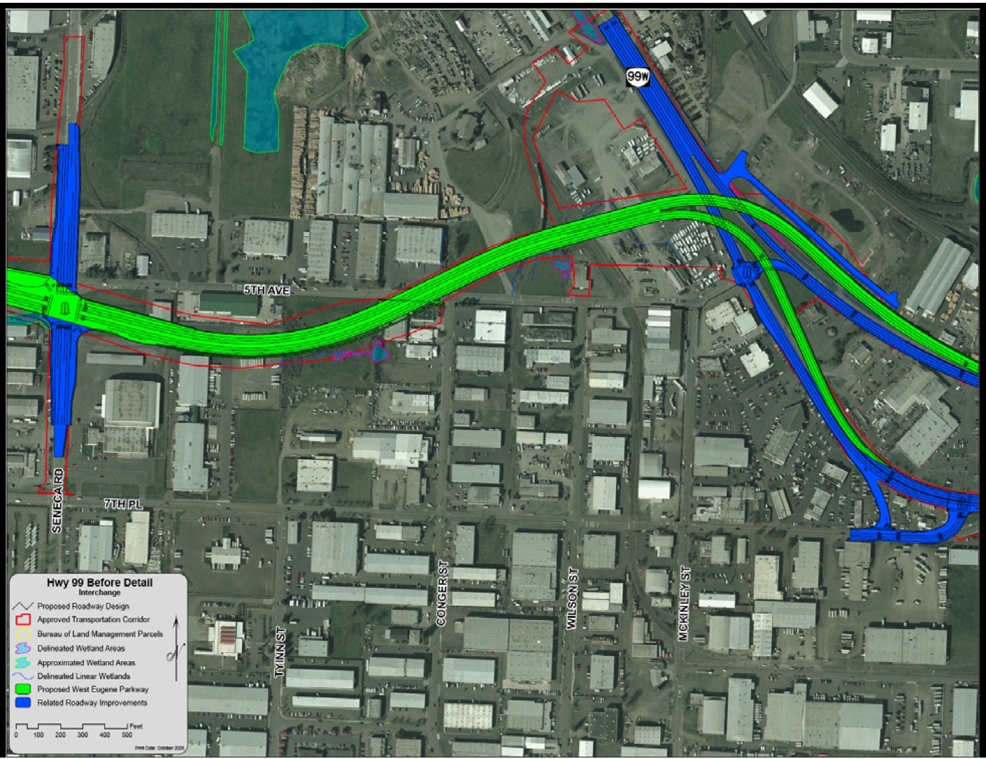
Eastern Terminus
WEP grade separated interchange over southbound 7th Avenue
a larger option than 1997 "Modified Alternative" and
2003 design changes
note that eastbound WEP would overcross 7th Avenue and then merge into
it
1997 design considered until 2004 would have eastbound WEP terminate at
new street light near existing 5th / 7th intersection
Eastbound WEP traffic would not be able to turn left to access northbound Highway 99.
This map was posted on ODOT's website in January 2006, it makes the ramp configuration of this alternative much more clear.
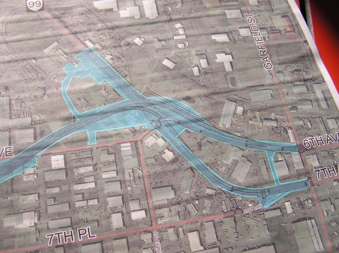
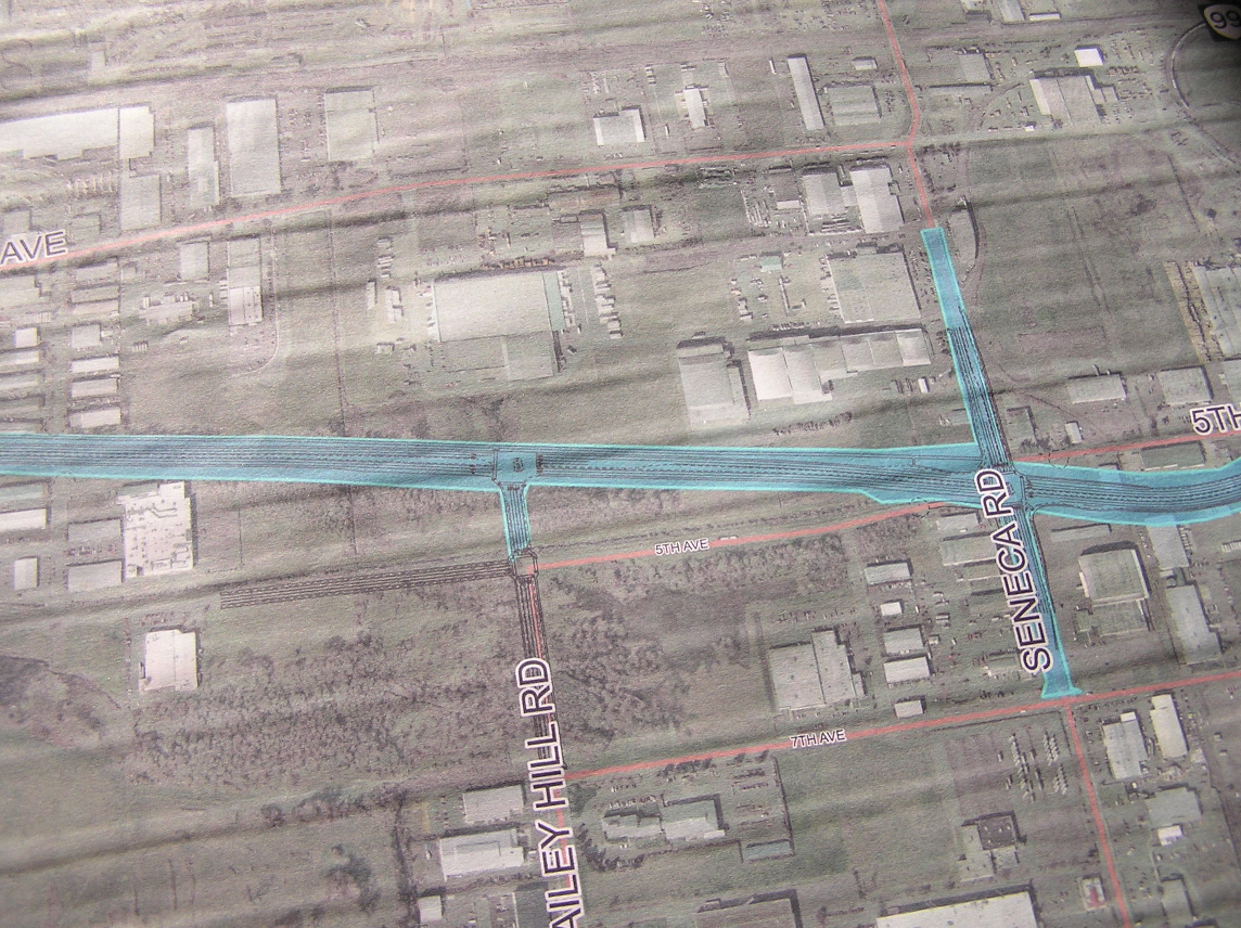
WEP / Seneca - Bertelsen intersections
WEP would not have left turns onto Seneca
north or southbound
(Seneca would have left turns onto WEP in both directions)
This truncated design was selected due to extreme congestion at WEP /
Seneca that would require an expensive grade separated interchange to
accommodate all directions of travel. Westbound WEP traffic would need
to turn at Bailey Hill and then double back on 7th Avenue to reach southbound
Seneca. Eastbound WEP traffic would need to go south on Bailey Hill, west
on 7th and then north on Seneca to reach the industrial area north of
Seneca / WEP.
Much of the forest around the WEP / Bailey Hill intersection is part of Bertelsen Nature Park, administered by the BLM.
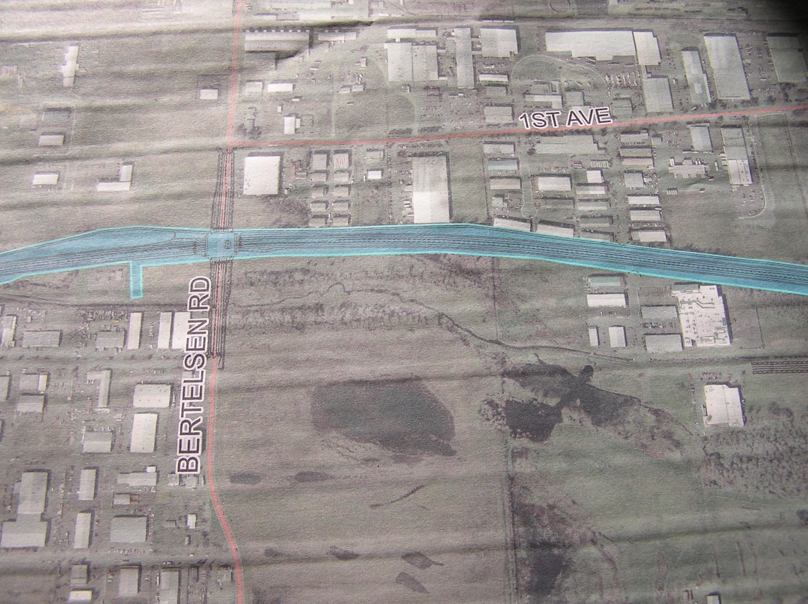
Bertelsen intersection
The WEP would decimate the Bertelsen Nature Park area east of Bertelsen Road. Bertelsen Slough, an important tributary of Amazon Creek, is southeast of the proposed intersection.
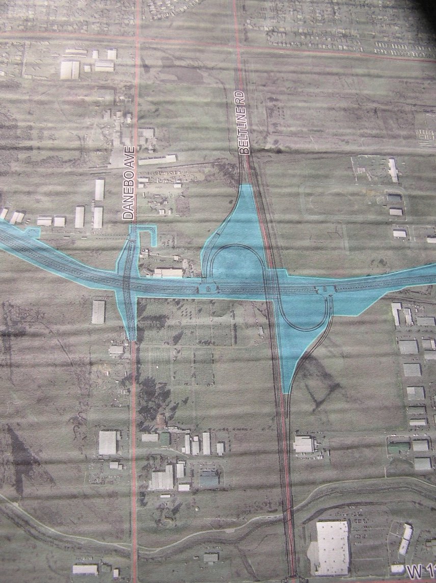
Beltline / WEP interchange
Danebo overcrossing, no WEP connection
Terry Street Extended / Amazon Creek Crossing
The WEP bridge over Amazon Creek would be just west of the Terry Street / WEP intersection. Most of the land around the Terry Street / Amazon Creek area is part of the BLM nature park (the forested area that would be sliced by the Terry Street extension is a tree farm owned by the Weyerhauser plywood factory on Danebo Avenue). The new bicycle path is the white line along Amazon Creek, and the railroad line is barely visible in this photo (it crosses Danebo between the words "Danebo" and "Ave" and it goes under Beltline about the location of the letter "B").

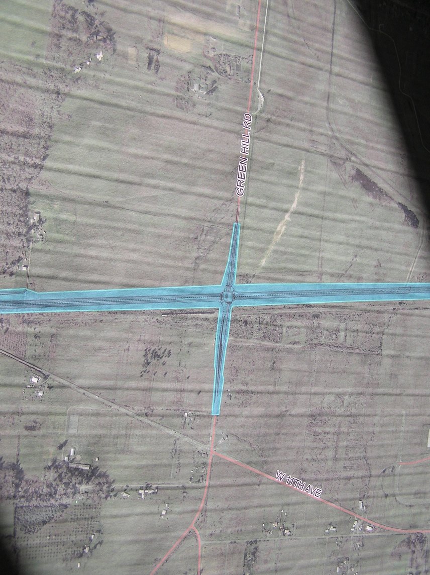
WEP / Green Hill intersection - at western edge of Eugene
The northeast, southeast and southwest quadrants around this intersection are mostly BLM preservation lands. The northwest quadrant is land owned by ODOT and it is reserved for future "wetland mitigation" area to offset the destruction of intact ecosystems, a practice mandated by the Clean Water Act yet is a poor imitation of natural processes. There is not enough land in the West Eugene Wetlands to properly "mitigate" all of the impacts of the Porkway plus all of the associated paving that would follow in the wake of the WEP (more big box stores, more subdivisions, tributary roads, etc.)