WEP would not solve traffic problems
WETLANDS alternative: fewer traffic lights for most trips
|
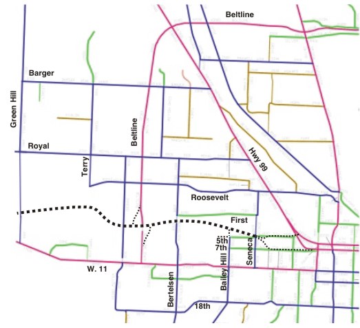
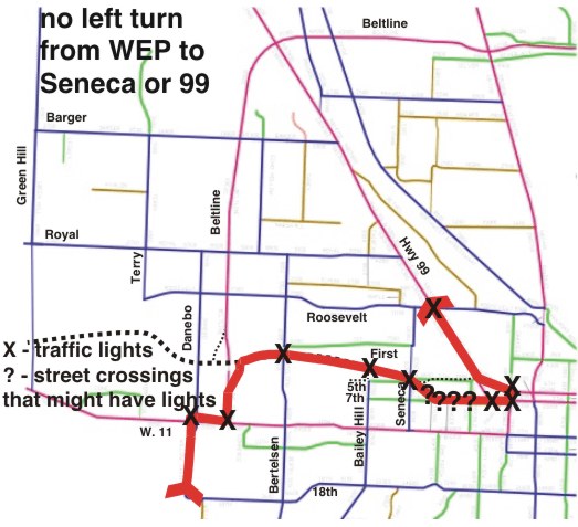
baseline map courtesy of the "City of Eugene Purple - Major Arterial Blue - Minor Arterial Green - Major Collector Brown - Neighborhood Collector Dashed Black line represents the WEP (2006 route)
this page is best viewed on a monitor with at least 1024 x 768 resolution (preferably more)
|
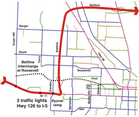
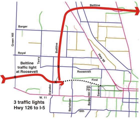
| Highway 126 to I-5 - without WEP | Highway 126 to I-5 - with WEP |
 |
 |
| downtown to Home Depot - without WEP | downtown to Home Depot - with WEP |
 |
 |
| Veneta to Hyundai - without WEP | Veneta to Hyundai - with WEP |
 |
 |
| Kalapuya High School to downtown - without WEP | Kalapuya High School to downtown - with WEP |
 |
 |
| First at Wallis to Tyree Oil Depot - without WEP (alternative) | First at Wallis to Tyree Oil Depot - with WEP |
 |
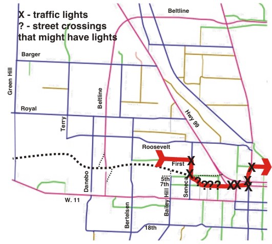 |
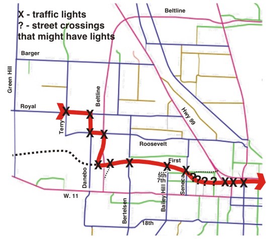
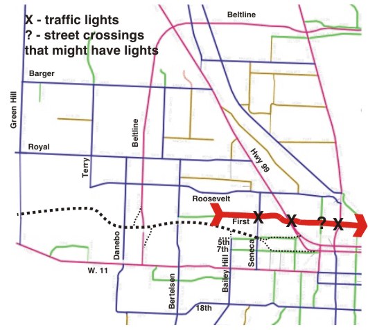
| Hyundai to Roosevelt/99 - without WEP | Hyundai to Roosevelt/99 - with WEP |
 |
 |
| Danebo/Royal to BiMart warehouse - without WEP | Danebo/Royal to BiMart warehouse - with WEP |
 |
 |
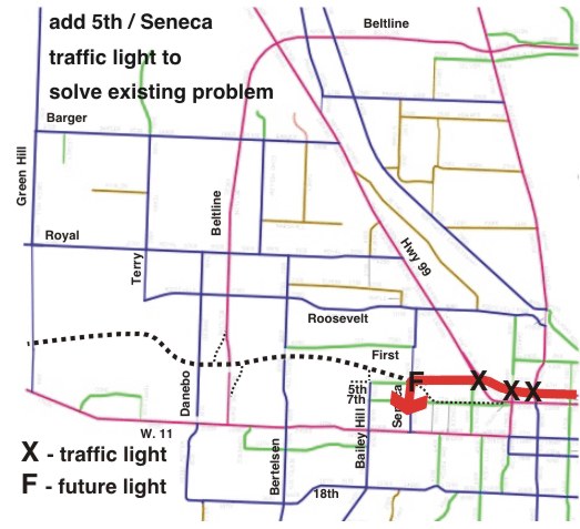
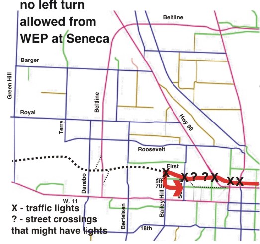
ODOT and Lane County employees have been vague about the number of traffic lights on this "couplet" segment, what would happen to businesses that currently have frontage access to 7th Place and other roads converted into the WEP, the train crossing of 5th (which would obstruct WEP traffic), among other issues.
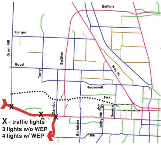
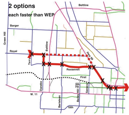
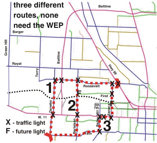
Eastbound WEP would have more traffic lights between the western and eastern termini than the WETLANDS alternative, and two of the traffic lights on the WETLANDS alternative could be removed with Alternative 2 (flyover ramp westbound 11th to northbound Beltline, interchange between Roosevelt and Beltline).
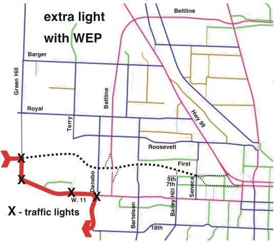
Westbound WEP traffic would have about the same number of lights as the WETLANDS alternative, depending on the final designs of WEP and the WETLANDS alternative. If the WEP couplet on 5th has traffic lights to control access to local streets, this would have more light on WEP than WETLANDS. WETLANDS alternative 1 could reduce a light with a merging ramp from southbound Beltline to westbound 11th. Alternative 2 adds a light by constructing an interchange at Roosevelt (which is avoided by eastbound WETLANDS traffic. Another light could be eliminated if the West 11th / Green Hill intersection is turned into an interchange, as suggested by some ODOT literature in 2001 before the Measure 20-54 referendum (ODOT's plans in case the WEP is not built).
However, most WEP traffic would not be from point to point - the eastern part would be the most crowded segment, and this is the part that ODOT is building to the lowest design standards.
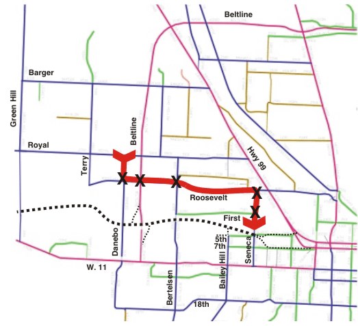
Eastbound WEP - 12 traffic lights
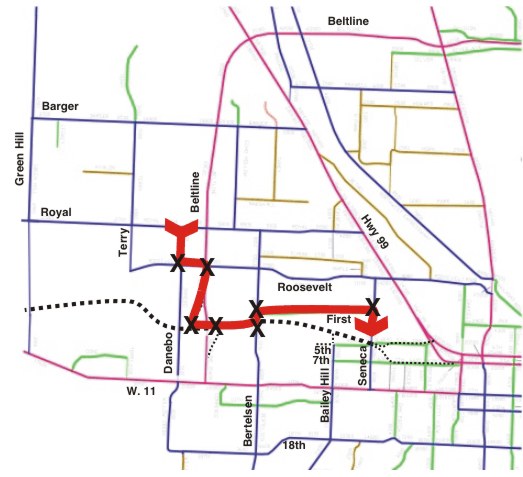
Eastbound WETLANDS Alternative 1 (no Beltline Phase 3) - 11 traffic lights
Eastbound WETLANDS Alternative 2 - (flyover ramp 11/BL, Roosevelt Interchange)
- 9 traffic lights
Westbound WEP - 7 or 9 traffic lights
Westbound WETLANDS Alternative 1 - 8 traffic lights
Westbound WETLANDS Alternative 2 - 9 traffic lights
WEP proponents often claim that the highway would "relieve" west 11th traffic, and therefore the fact that most intra-city trips would not directly benefit from any WEP induced shortcuts is not relevant. However, the WEP would roughly double traffic on the north-south feeder roads between WEP and west 11th (Seneca, Bailey Hill, Bertelsen, Beltline), which would cause west 11th intersections that currently function adequately to become overloaded. The WETLANDS alternative would fix existing west 11th intersections and create a distribution of fixes throughout the industrial area to mitigate traffic impacts -- even without considering the impact that the end of cheap oil will have on Eugene area traffic patterns.