Land and Water Conservation Fund
WEP properties
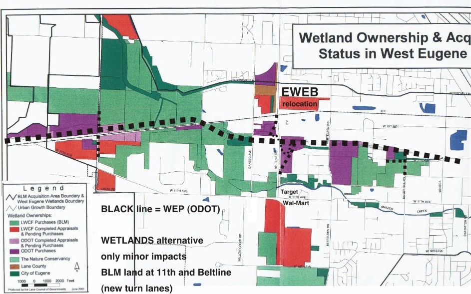
Scanned in map of "Wetland Ownership and Acquisition Status in West Eugene Area," produced by Lane Council of Governments, June 2001.
The dashed lines represent the route(s) of the so-called Parkway to indicate which public lands would be destroyed.
If the Beltline / West 11th intersection is significantly widened for the WETLANDS alterantive (or even as part of the WEP), the edge of some LWCF property would need to be condemned. However, if this was done instead of the WEP (and the rest of the WEP was genuinely canceled by converting the ODOT property to BLM conservation areas), this would meet the legal requirements for "avoidance, then minimization" that apply to wetland destruction permits (section 404 of the Clean Water Act) and protection of parklands and publicly owned wildlife refuges (section 4(f) of the 1966 Transportation Act).
The DARK GREEN shows parcels owned by the City of Eugene - note that they own two parcels in the path of the porkway: one immediately west of Danebo, and one at the proposed Bailey Hill / WEP intersection. When these parcels are transferred to the BLM for preservation and restoration, then the WEP will be on the way out.